We recommend drawing the mission polygon at the office to increase work efficiency before heading to the field.
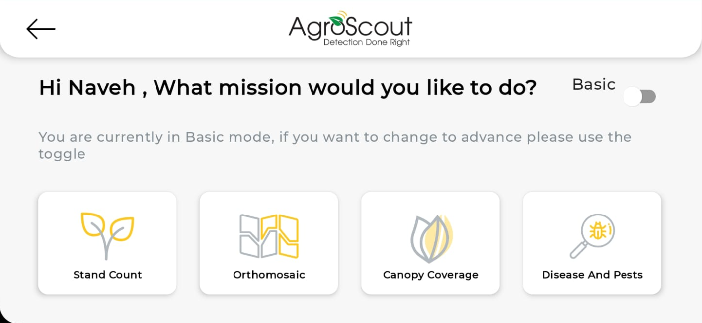
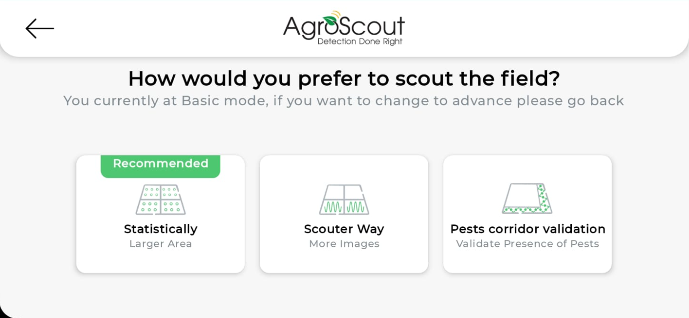
Select a mission and a pattern.
Write a mission name.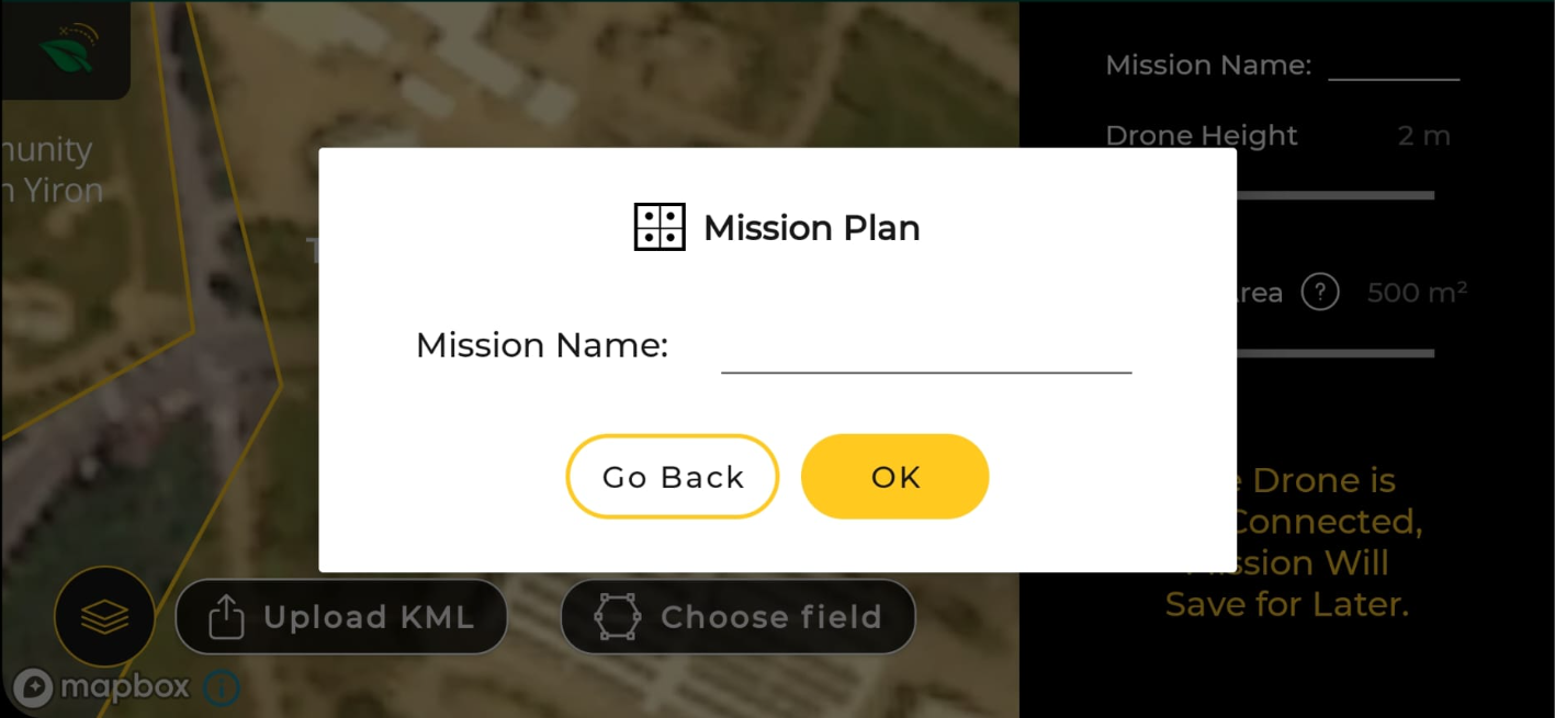
Minimize the mission setting slider.
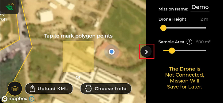
There are four options for polygons creations:
- Self-drawing based on the satellite map.
- Self-drawing based on orthophoto or satellite NDVI.
- Upload KML file.
- Choose field - auto-pattern filling based on the field boundaries.
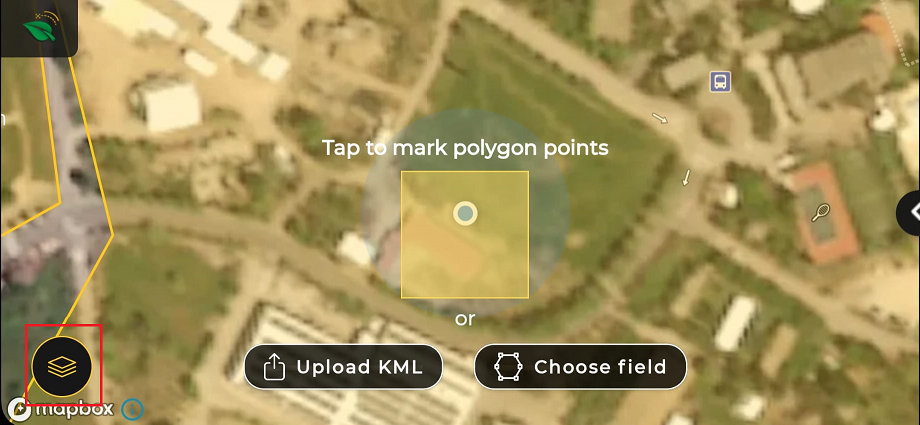
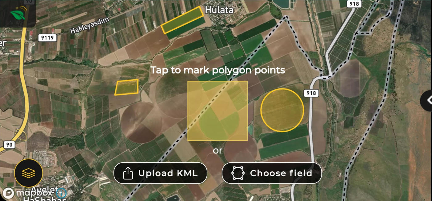
Self-drawing based on the satellite map
Place the yellow square on your field, and tap on the screen.
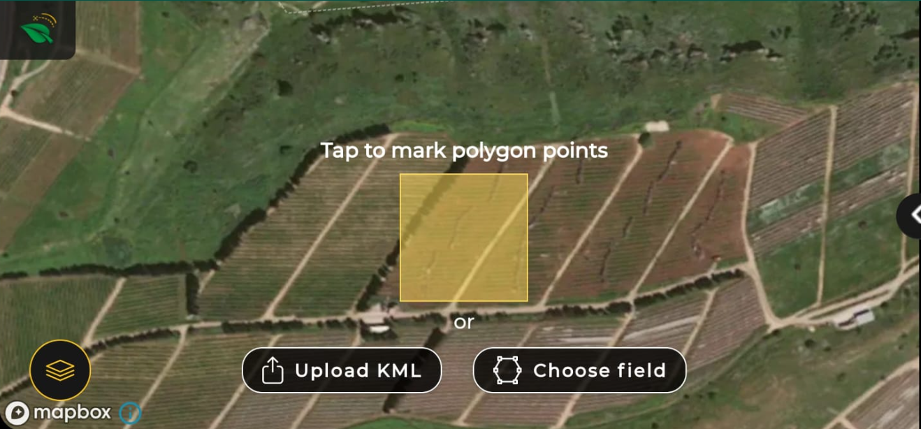
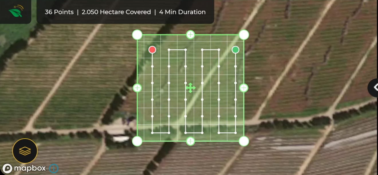
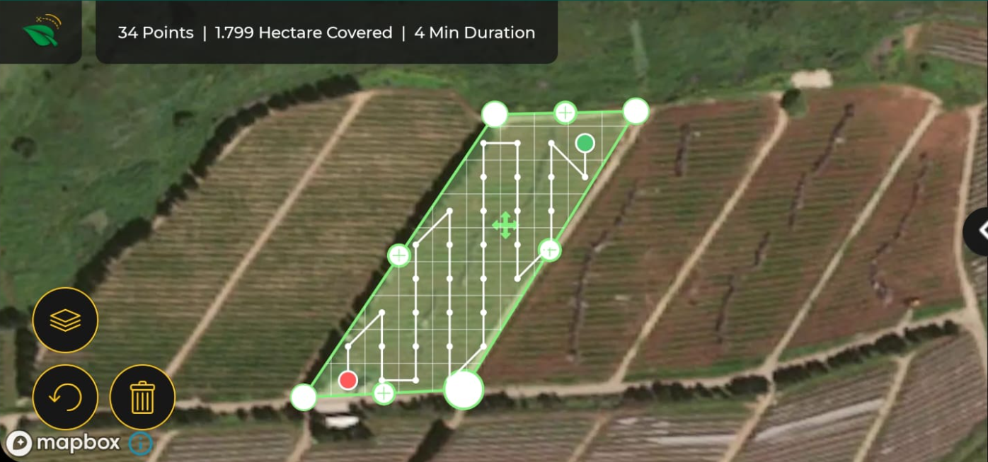
Adjust the edges of the polygon by dragging the white circles to the actual boundaries of the field.
Note:
Press the reload button to return to the previous edges.
Press the "+" sign to open a new circle to draw a non-cubic structure on the field.
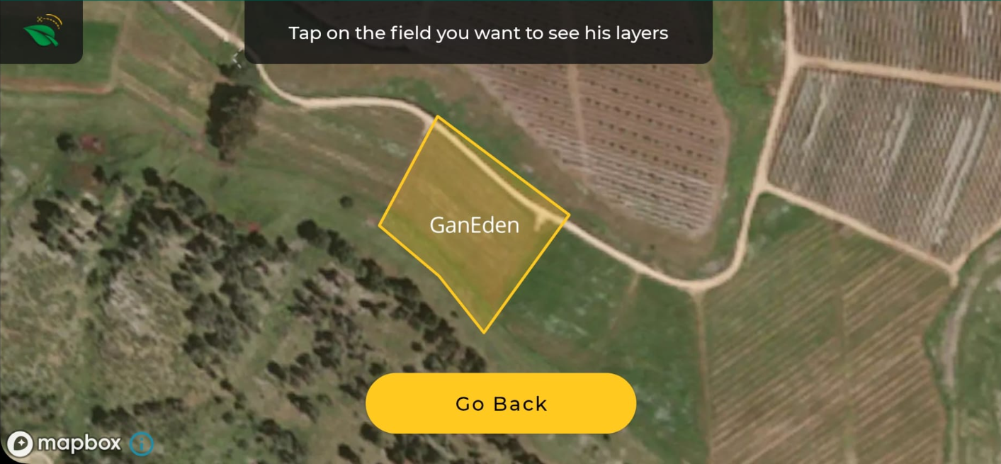
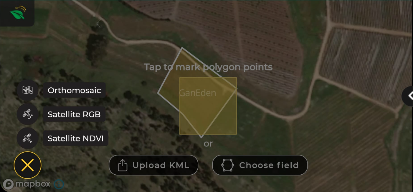
Self-drawing based on orthophoto or satellite NDVI
*Internet required.
Press on the layer icon.
Select a field with an orthophoto or satellite NDVI layer (marked in yellow boundaries).
Select layer type.
Select the date of the layer.
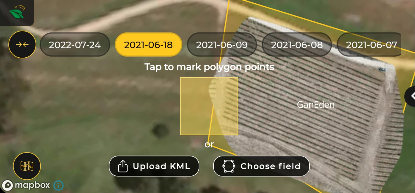
Follow the process of self-drawing.
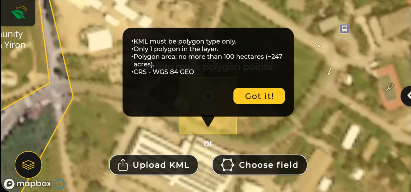
Upload KML file
Download the KML file to your mobile or smart controller device before planning the flight mission.
Press on "Upload KML". Note the system restrictions message.
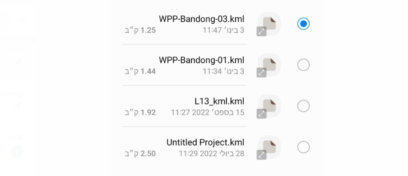
Select the KML file.
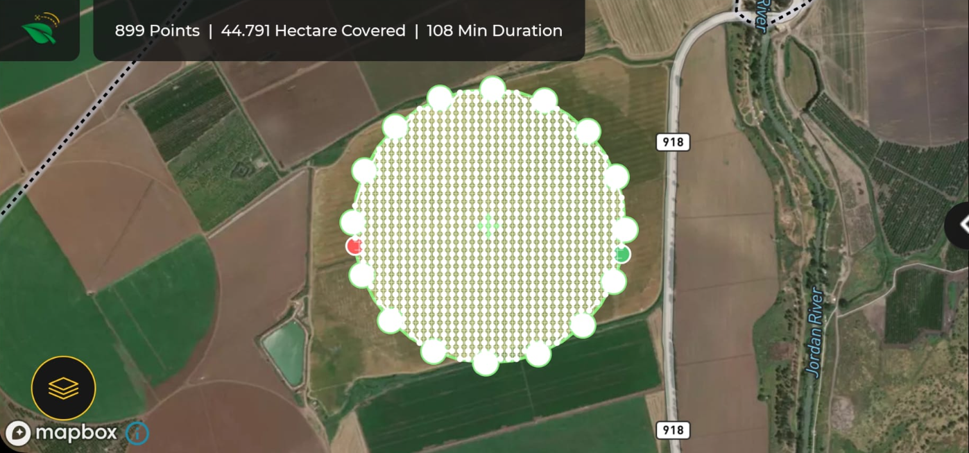
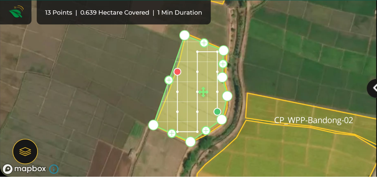
The pattern will be created automatically to cover the entire field. Adjust the polygon borders if required.
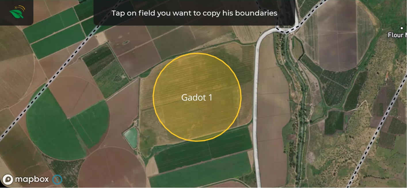
Choose field - auto-pattern filling based on the web field boundaries.
*Internet required.
** Field must exist on the web.
Press on "Choose Field."
Tap on the desired field.
Press "Next."
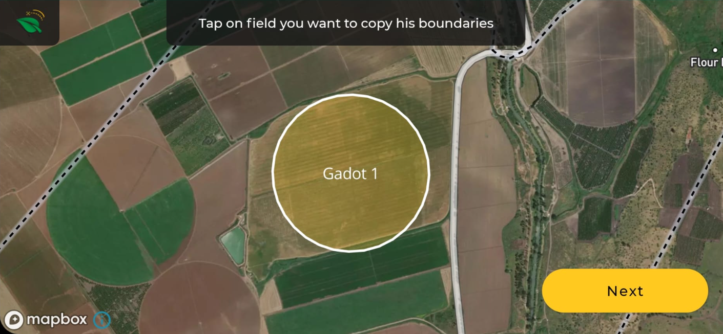
The pattern will be created automatically to cover the entire field. Adjust the polygon borders if required.