The NDVI/RGB and the orthophoto layers you have on the web platform will be updated on the Sky Application every time you connect your mobile phone or smart controller to the internet.
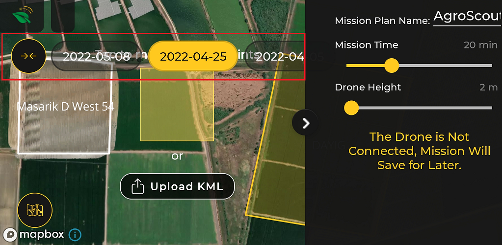
Select a mission on the Sky App. The layers will work on any mission.
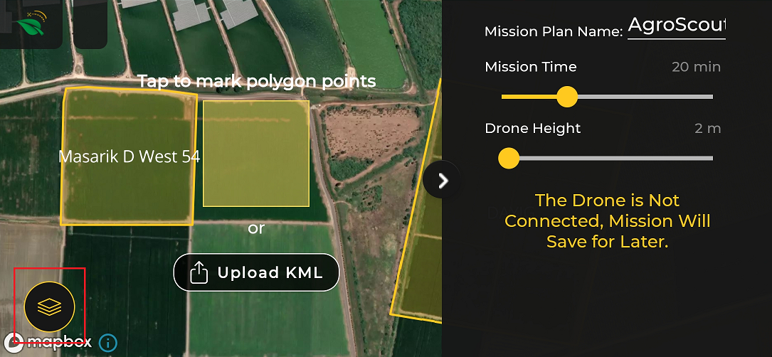
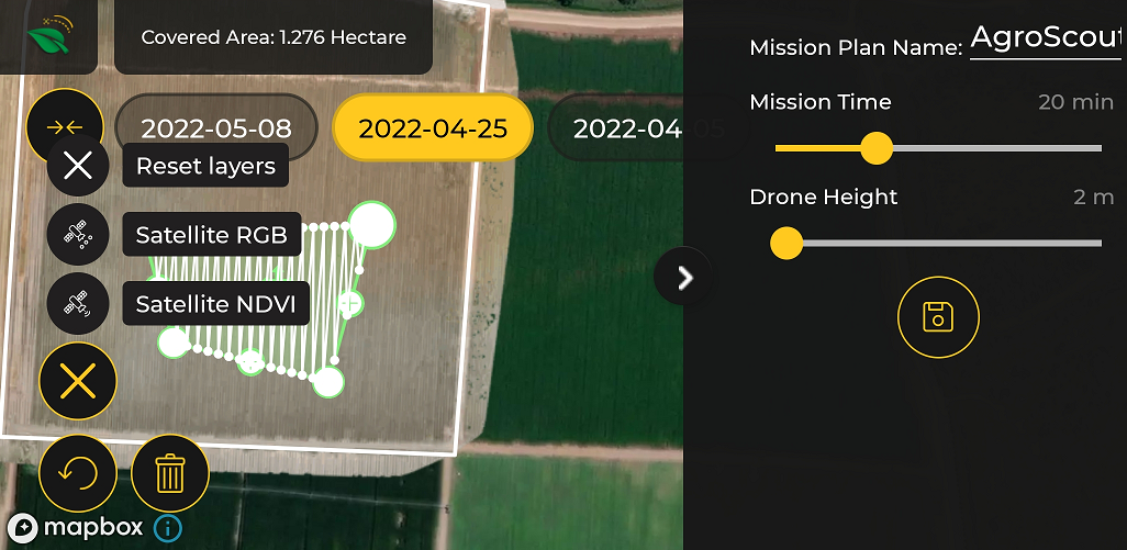
Press the "Layers" logo on the bottom right of your screen.
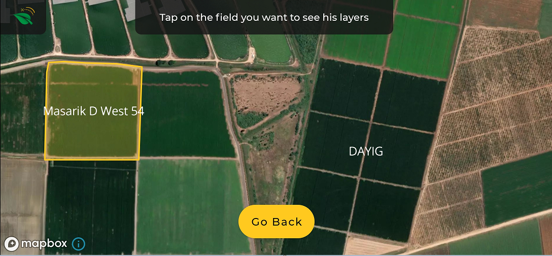
Tap on the field you want to see its layers. Only fields created on the web platform and marked in yellow are relevant.
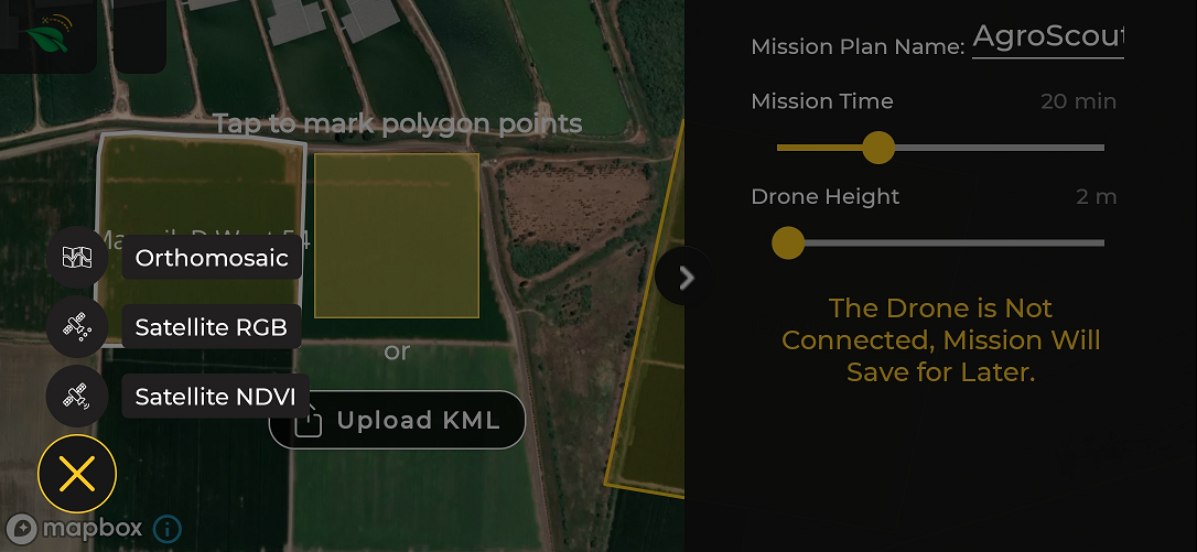
A "Layers" option will open. Select one of them.
A layer will be open only if the selected field has one.
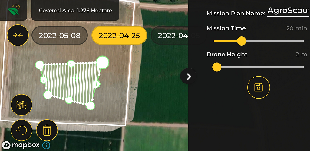
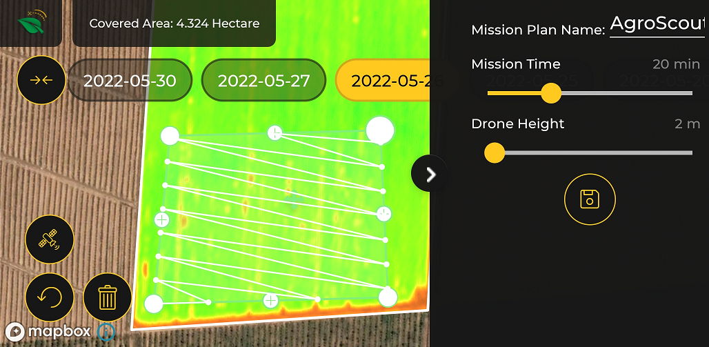
Select the date of the layer you want to work with.
Design the polygon of scouting on the selected layer.
Reset or change "Layer" by re-pressing the map logo.
Go "Fly."